Hiking
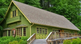 Educational exhibits and guided waterfall walks in season. Rangers provide general information about Delaware Water Gap National Recreation Area.
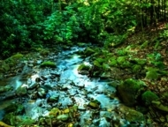 Take a hike on the 63 acres, see the remains of a historic springhouse and pumphouse. 2 ponds are great for fishing.
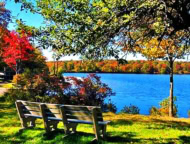 Crystal-clear 170-acre lake on 5,440 acres of forested park. Boating, fishing, swimming, hiking, picnicking. Camping, snowmobiling, ice skating, ice fishing.
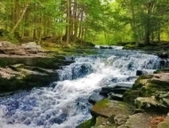 Gentle, really fun little trail along the stream. hopping from rock to rock. 2.7 miles, features a lake, good for all skill levels. Bring Fido, great for kids.
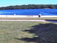 170-acre crystal-clear lake with a sandy beach. Picnic tables, changing areas, bathhouse. Camping is available.
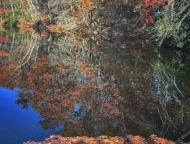 26 miles of uninterrupted rail trail runs through Lehigh Gorge State Park from White Haven to Glen Onoko. The entire length of Lehigh Gorge is ideal for walking or off-road biking.
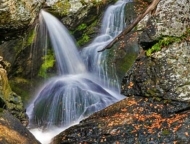 Designated Pennsylvania’s best trail in 2019 by Outside Magazine. 3 miles long and marked by bright orange blazes. Tumbling Waters waterfall.
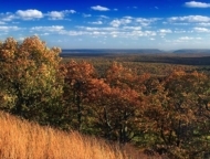 Mount Wismer abuts 170-acres of Gravel Family Nature Preserve. Hardwood forest, open fields, hiking trails. Great scenic view.
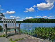 Research, education, preservation. 52-acre Lake Lacawac is a glacial lake preserved in almost pristine condition. Hiking on 8 trails, boreal bog, ponds, streams. Open to the public.
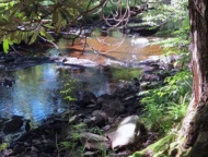 2-mile gravel and dirt multi-use trail crosses a ford. Takes an average of 17 minutes to complete. Trail Difficulty is rated “Easy”.
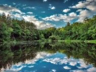 Prime trout fishing lake in a 65-acre preserve. Small manmade lake where you can walk over 1.5 miles of wilderness trail. Picnic tables and benches.
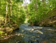 3.2 miles through upland oak/pine forests and open fields along the Kittatinny Ridge, good for hiking, fishing, and cross-country skiing.
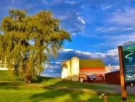 Three miles of publicly accessible walking trails through the woods and wildflower meadows, along with two ponds, wetlands, and a tributary to Beach Lake Creek.
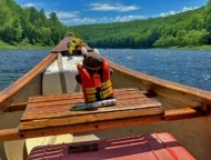 73 miles of the Delaware River, the longest undammed river in the eastern U.S. Canoe, hike, fish, and observe Bald Eagles!
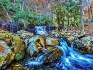 Devil’s Hole Trail is a 3.1 mile moderately trafficked loop trail that features beautiful wildflowers. The trail is primarily used for hiking and walking. Best used from April until October.
 1 mile moderately trafficked out and back trail featuring beautiful wildflowers. Best used from April until October. It’s a short hike straight up and down.
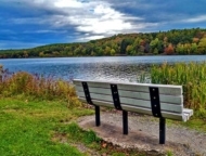 Great for camping, fishing, hiking, and boating. 165-acre horseshoe shaped lake, boat launch, and it’s got a campground.
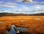 2,800 acres of glorious state forest wrapped around the 250-acre Gouldsboro Lake. Hiking, boating, swimming, fishing, cross-country skiing, ice fishing, and picnicking.
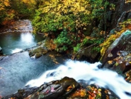 16,000-acre natural area. Public beach, campground, 44 miles of hiking trails. Trout fishing, swimming, disc golf, winter sports. Waterfalls, lake.
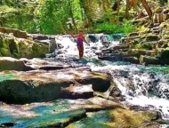 Year-round hiking, fishing, swimming, boating, biking, picnicking, camping, ice skating. 2 lakes on 3,000 acres of forested land. Cabins, tent sites.
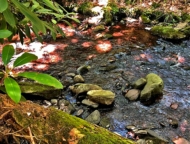 An easy “lollipop” loop of about one mile. Pack out what you pack in. Fishing and hunting are not allowed. Great for kids.
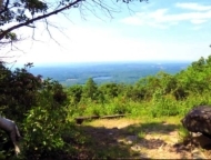 Leads to the original railroad crossings in Big Pocono State Park. Fantastic view. Bikes, horses, skis, and snowshoes are permitted. Bring your dog!
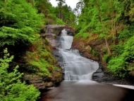 Highest falls in PA, only a few feet shorter than Niagra Falls. Short hike, boardwalk along 70%. Come early on weekends, wear comfy shoes.
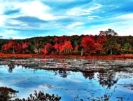 78 acres of quiet natural beauty with 2.5 miles of hiking trails through hemlock forests and hardwood glens, along creeks and shorelines, the sanctuary’s scenery makes for a perfect trek.
 61.5-acres of a section of the Pocono Creek with Class A wild trout waters. Thickets of old-growth rhododendron, colonies of spring wildflowers, and wetland habitats.
 This peaceful 300-acre park of forest, meadows, and wetlands offers a picnic pavilion and well-marked, easy trails.
 1/2 mile trail made of smooth boardwalk paths. Rhododendron and hemlock. Ends at the base of Dingmans Falls.
 Owns 10 nature preserves and 2 conservation easements in Monroe County Fishing, hiking, wildlife. Open to the public from dawn ’til dusk, 365 days/year.
 The preserve is home to 3.4 miles of trails. The single-track hiking trails form four different loops, which offer a challenging, yet rewarding trek along the ravine.
 Impressive waterfall that is roughly 75 feet wide and 50 feet tall. Trails lead down the side of the falls as well as along the top of both sides of the ravine.
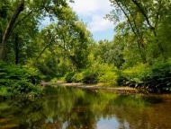 Cool, shady, and dense with trees offering rich habitat for wildlife, passes over and under busy Route 80. Stepping stones over Cherry Creek, overlook of town at the top.
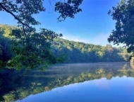 4 miles of hiking and mountain biking trails Invigorating hikes and exciting switchbacks for mountain bikers. Forested cliff that provides mile-long views.
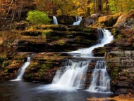 2nd highest waterfall in PA. Boardwalk trail, 2 waterfalls. Hemlock, rhododendron, birds, wildlife. Visitor center.
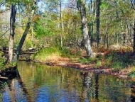 The Nothstein Preserve in Cresco spans 150 acres of pristine Pocono forests, crystal-clear streams, and a plunging gorge with 3.4 miles of trails
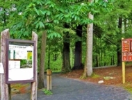 Site of a number of cascade waterfalls along Dingmans Creek, best trail in the Delaware Water Gap for waterfall lovers.
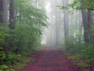 32 miles point-to-point. The trail offers miles of easy to moderate hiking, thanks to its crushed gravel surface. Not crowded. Free weekend shuttle service.
 Hiking, picnicking, fishing in season (with license). Popular spot for fly-fishing. Covered pavilion with picnic tables and BBQs.
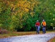 Great for hiking and biking. Trail runs parallel to Mauch Chunk Creek, provides easy access for fishing. Shuttle service, bike rental available in Jim Thorpe.
 Protected natural area and open space property on the banks of Tank Creek, adjacent to Devil’s Hole State Gamelands #221.
 300-acre piece of land located right on the shores of Lake Wallenpaupack. This slice of natural Poconos paradise is one of the last areas on the lake that hasn’t been developed.
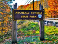 150 acre park with the world’s largest glacial pothole formed during the Wisconsin Glacial Period around 15,000 years ago. Bring the kids, and Bring Fido!
 80,000 lush acres filled with glacial lakes and bogs. Hiking, mountain biking, ATV trails, 13 lakes and ponds for fishing, camping.
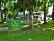 Fly fishing resort on the banks of the West Branch of the Upper Delaware River. They offer lodging, guide services, and a fly shop.
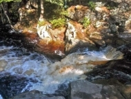 Excellent, fairly easy, day-hike loop to explore in the Pinchot State Forest. Streams, cascades, wetland meadows, diverse forests, and the beautiful Choke Creek Falls.
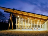 (PEEC) in the 77,000-acre DWGNRA offers 12 miles of hiking trails, weekend educational programs, conference facilities, and summer camp.
 High-Quality Coldwater Fishery and Class A Wild Trout Fishery. 511 acres, great hiking, crystal clear waterfalls.
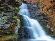 300 acres, including 8 waterfalls and more than 2 miles of hiking trails, bridges, and walkways. Picnicking and grilling area, paddle boats, mini-golf, fishing.
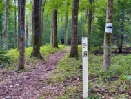 6.3 mile moderately trafficked point-to-point trail near Greentown. it’s wild and wooly and has tons of huge rocks and water. Rated as moderate. Hiking, running, nature trips year-round.
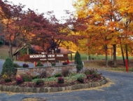 Free, open to the public daily from 10 am to 8 pm. Well-equipped playgrounds for the kids are the feature. Mountain terrain, picnic tables, grills.
 Bruce Lake Natural Area is part of the Delaware State Forest with 2,900 acres of land and miles of trails. Egypt Meadow lake and Bruce Lake.