- 745 Red Rock Rd,
- Cresco 18326
- (570) 839-1120
Red Rock Trail is part of the Mount Airy Trail Network on lands protected by a conservation easement. It’s open for hikers from 8 am ’til dusk. There’s no hunting, fishing, ATVs, or other motorized vehicles allowed, so you can hike free.
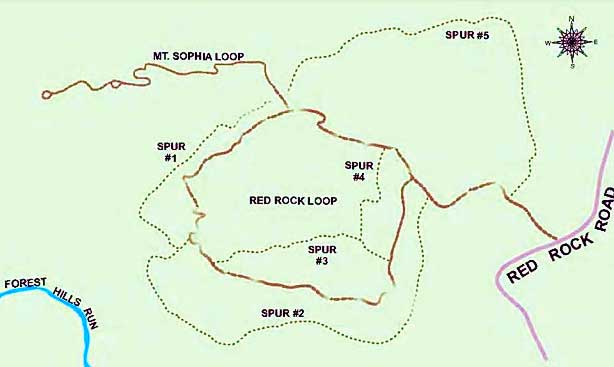
The map at the trailhead kiosk shows 4 miles of trails. The center loop is a wide, gravel path of about a mile. In early spring, the wetland at the start of the trail is alive with salamanders, spring peepers, wood frogs and other creatures laying their eggs. Dense stands of native mountain laurels put on a stunning show here from late May into June.

Single-track spurs of gravel curve out and around the center, providing views through oaks and maples toward the north and Camelback to the south. The spur to Mount Sophia takes you to a pine and hemlock upland at 1,600 feet. When the leaves fall, your climb is rewarded by lovely, long views over hills in all directions, and toward the edge of the Pocono escarpment in Mount Pocono.
Even on this relatively dry ridge of rock, water rises. Water from these wetlands, seeps and tiny runs flows into Paradise Creek and Forest Hills Run, and then the Brodhead on its way to the Delaware River. People walk these trails a lot. Yet even when no human is here, this protected land acts like a free, natural water treatment plant, filtering and purifying water — pure drinking water for everyone from Kalahari to Stroudsburg, who get their drinking water from Brodhead Creek.
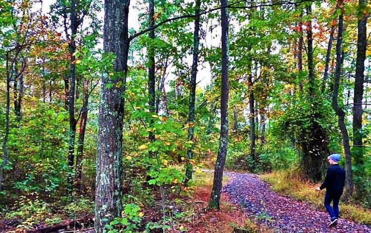
Trails are well-groomed, but frequently have fallen oaks to climb over. Many sections of the trails have stone steps and switchbacks. The map at the trailhead kiosk shows 4 miles of trails. The center loop is a wide, gravel path of about a mile.

Mourning doves, wood thrush, pine warblers, veerys, and other birds keep company on the trail. Blue-eyed grass, sweet fern, wild strawberry, blackberries and blueberries, wild geranium, witch hazel, bracken fern, mountain azalea, mosses and lichen abound.
Leashed dogs welcome. Owners must clean up and carry out waste.
No trash receptacles. Please pack out whatever you pack in.
Mount Airy Trail Network’s Red Rock trailhead on Red Rock Road. From Route 191 in Paradise Valley, Pa., take Red Rock Road for eight-tenths of a mile. Trailhead is on your right.
“This trail is best during the fall through spring to enjoy the views through the trees. There is no hunting nor atvs allowed. There are no restrooms. The trails are well blazed and have clear signage.
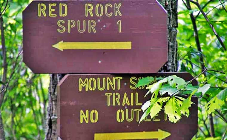
The main loop is a gravel path with occasional stone “steps”. The Mt. sophia trail is a natural hilly hike but also has gravel filled railroad tie steps in some places. Allow an additional 30 minutes if you add the Mt. Sophia trail in with the main Red Rock loop trail. Keep in mind, during the summer, there’s no clearing through the trees to see the views.
There are 10 information signs along the main Red Rock loop trail explaining things like vernal ponds, teaberry, standing deadwood, etc. They are a nice addition. One sign is posted near two natural split log benches suggesting to take a moment to sit and listen to the sounds around you.”


