Hiking
 Shades of Death Trail is a 2.4 mile out and back trail located in White Haven’s Hickory Run State Park. Hiking, running, and bird watching. Best May – Oct.
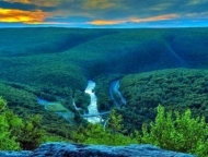 Steep but easy-to-follow trail leading up Mount Pisgah to a pair of fantastic Carbon County vistas. 1.4-mile out-and-back trail that’s considered a moderately challenging route.
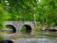 Moderately difficult 3-mile loop trail off the Ten Mile River. Best from late September through the end of October.
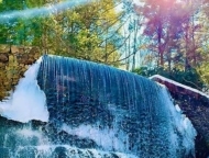
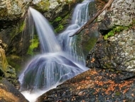 Designated Pennsylvania’s best trail in 2019 by Outside Magazine. 3 miles long and marked by bright orange blazes. Tumbling Waters waterfall.
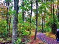 Open year round, 8am ‘ti dusk. 4 miles of trails. Leashed dogs welcome. Single-track spurs of gravel curve out and around the center.
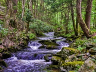 The preserve is home to 3.4 miles of trails. The single-track hiking trails form four different loops, which offer a challenging, yet rewarding trek along the ravine.
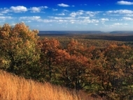 Mount Wismer abuts 170-acres of Gravel Family Nature Preserve. Hardwood forest, open fields, hiking trails. Great scenic view.
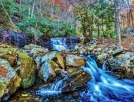 Devil’s Hole Trail is a 3.1 mile moderately trafficked loop trail that features beautiful wildflowers. The trail is primarily used for hiking and walking. Best used from April until October.
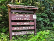 300-acre piece of land located right on the shores of Lake Wallenpaupack. This slice of natural Poconos paradise is one of the last areas on the lake that hasn’t been developed.
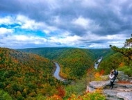 Provides a stunning vista above the Lehigh River Gorge near Mauch Jim Thorpe. It’s just a gorgeous view.
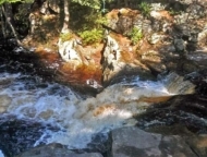 Excellent, fairly easy, day-hike loop to explore in the Pinchot State Forest. Streams, cascades, wetland meadows, diverse forests, and the beautiful Choke Creek Falls.
 1/2 mile trail made of smooth boardwalk paths. Rhododendron and hemlock. Ends at the base of Dingmans Falls.
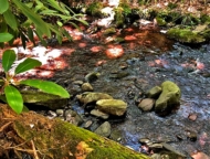 An easy “lollipop” loop of about one mile. Pack out what you pack in. Fishing and hunting are not allowed. Great for kids.
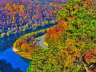 Southernmost peak of the Kittatinny Mountains is 1,526 feet tall, and forms the east side of the Delaware Water Gap. Across the Gap is Mount Minsi, on the Pennsylvania side of the river.
 6.3 mile moderately trafficked point-to-point trail near Greentown. it’s wild and wooly and has tons of huge rocks and water. Rated as moderate. Hiking, running, nature trips year-round.
 1 mile moderately trafficked out and back trail featuring beautiful wildflowers. Best used from April until October. It’s a short hike straight up and down.
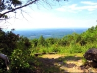 Leads to the original railroad crossings in Big Pocono State Park. Fantastic view. Bikes, horses, skis, and snowshoes are permitted. Bring your dog!
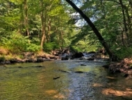 61.5-acres of a section of the Pocono Creek with Class A wild trout waters. Thickets of old-growth rhododendron, colonies of spring wildflowers, and wetland habitats.
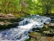 Gentle, really fun little trail along the stream. hopping from rock to rock. 2.7 miles, features a lake, good for all skill levels. Bring Fido, great for kids.
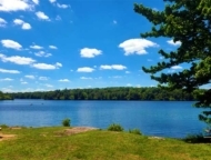 Follow the trail loop that circumnavigates the lake and passes by bogs, evergreen forests, and a plethora of plant and animal life.
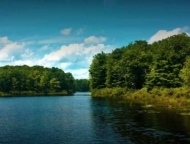 Bruce Lake Natural Area is part of the Delaware State Forest with 2,900 acres of land and miles of trails. Egypt Meadow lake and Bruce Lake.
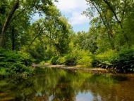 Cool, shady, and dense with trees offering rich habitat for wildlife, passes over and under busy Route 80. Stepping stones over Cherry Creek, overlook of town at the top.